Programa de Prevención y Control del Dengue 2024 | 08 Chihuahua
Vigilancia Epidemiológica
Cadenas de Transmisión
Mapas de Calor
Panorama Epidemiológico
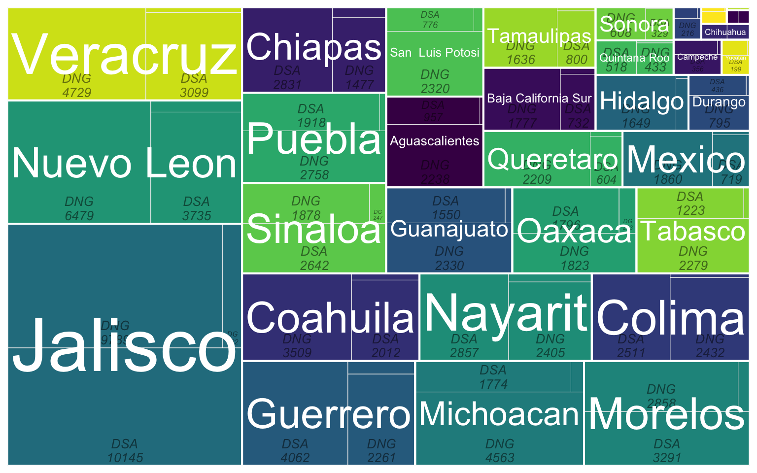
Casos por Municipio
Casos por Municipio
Expand
Expand
Expand
Expand
Expand
Expand
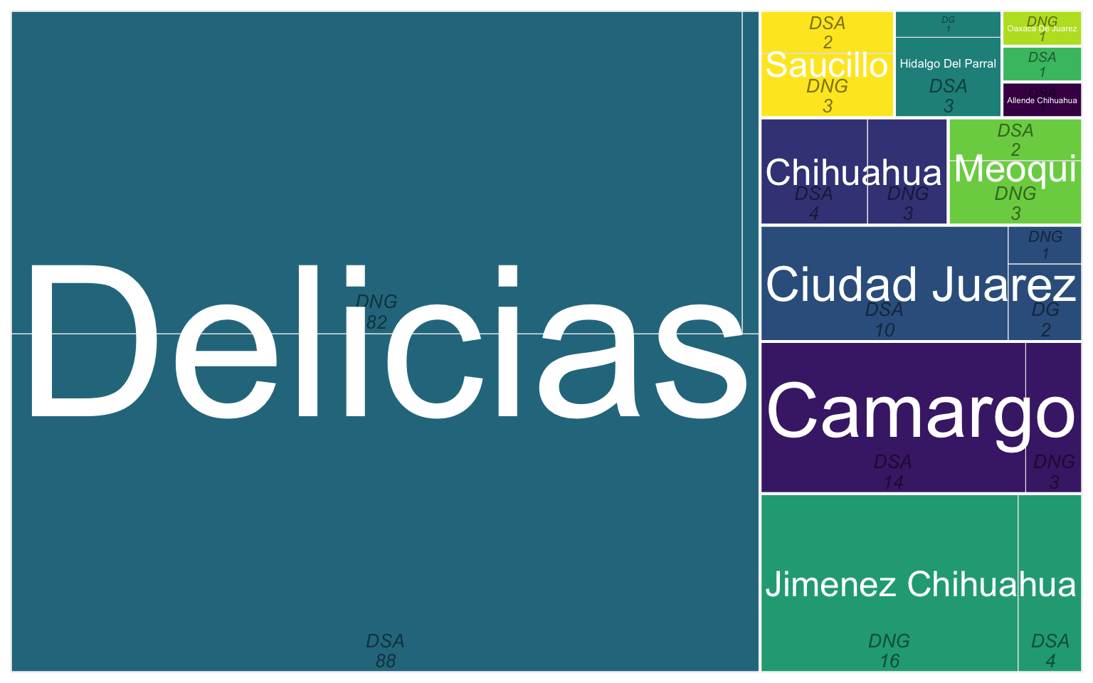
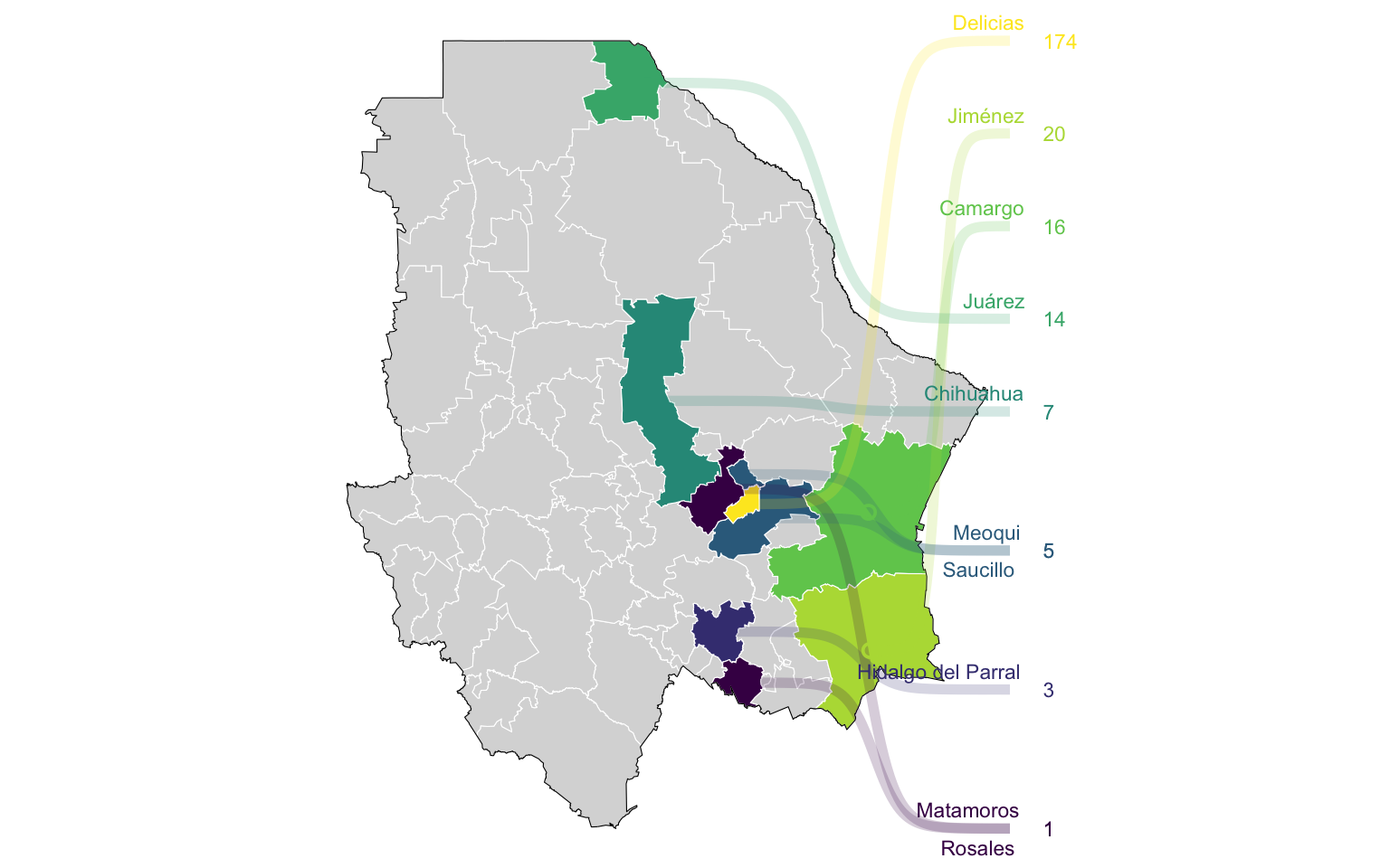
Delicias
Expand
Expand
Delicias
Acumulado
Último Mes
Últimas 2 Semanas
Expand
Expand
Expand
Expand